
3D scanning
Modelling
Data management
100+
Clients
15+
Countries
2050+
Scans
8+
Years active
<5
Days per scan




















































Our ambition is to be the go-to partner for the digital capture of buildings.
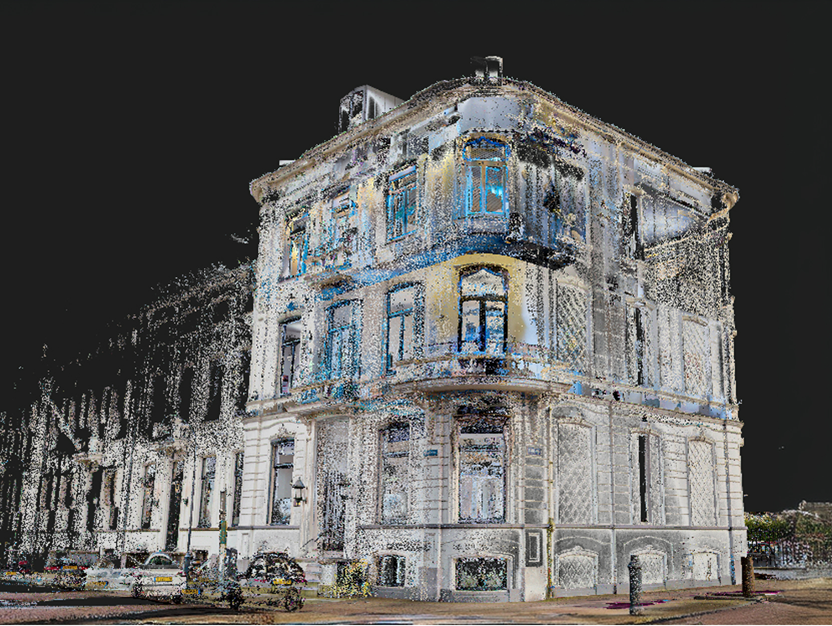
With our precise 3D scanners we create high-quality point clouds, which we can develop further into BIM models and technical drawings.
All project information, from point clouds and 360° photos to BIM models and drawings, is then accessible 24/7 via our Indoorviewer or cloud environment.


CREW-B started where many good ideas start: at school. We, two study friends from the Built Environment programme at the Amsterdam University of Applied Sciences, were given the assignment to start a company during the Startup Your Business in Technology (SYBIT) minor in our third year.
Scan-to-BIM & Digital Twins
The 3D scanning, modelling and data management of every project.
Our services

Scanning
CREW-B has three advanced NavVis VLX mobile scanners. Thanks to these portable scanners, buildings can be surveyed extremely quickly and with high precision. The resulting point cloud forms a reliable digital basis for renovation, management and new-build projects.
Based on the point cloud, we produce accurate 2D drawings, 3D models and BIM models. On request, we deliver the data in the RDNAP coordinate system (GPS), so it is directly usable within existing projects and GIS and BIM environments.
From an initial building scan to a complete Scan-to-BIM solution, we handle the full process. This gives you up-to-date, reliable and accurate building information as the basis for design, execution and management.

Modelling
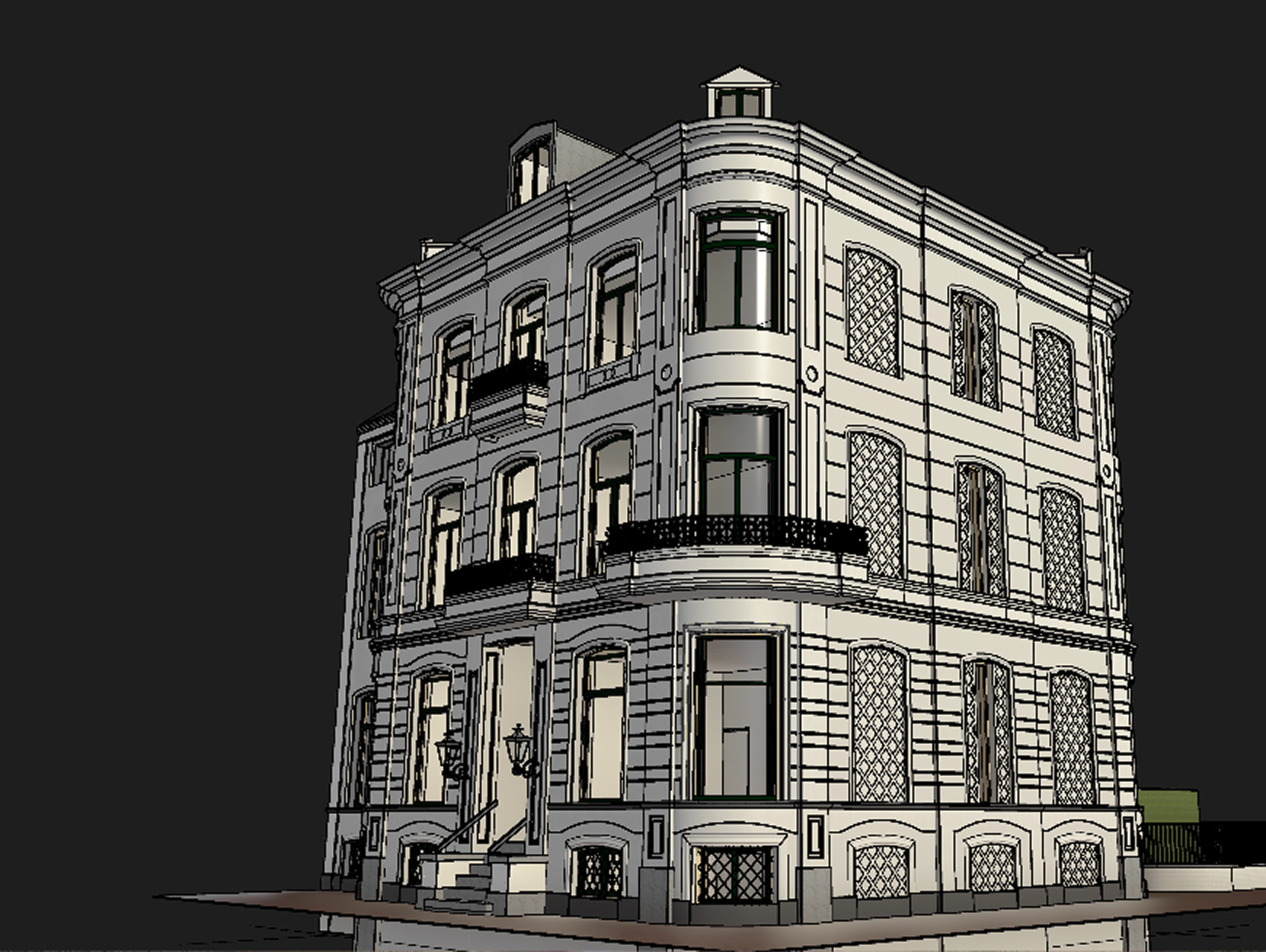
Once sufficient information is available from a 3D scan, point cloud and/or archive documents, we produce the required drawings and 3D models. Depending on the project need, we deliver 2D CAD drawings, Revit models, IFC models and BIM models, among others.
We work in Autodesk Revit and AutoCAD as standard, and model according to the applicable ILS agreements and the desired LOD/LOI on request. We also deliver native files, IFC and PDF files for optimal exchange with virtually all common software packages.
Because we work daily for a wide range of clients, we are used to modelling within different standards and templates. Does your organisation work with its own Revit or AutoCAD template? We fit in seamlessly.

Managing
A BIM model is only truly valuable when the information remains easily accessible and up to date. That is why we ensure that models, drawings and scan data are securely managed and available 24/7 to all parties involved.
For managing and sharing BIM models and drawings, we use Autodesk Docs. This gives clients, advisors and contractors constant access to the most current information, which can easily be consulted in both 2D and 3D.
The point cloud, including 360° photos, is also durably managed via our indoor viewer. This allows a building to be explored intuitively, distances to be measured and Points of Interest (POIs) to be added. This keeps all relevant building information clear and directly available after handover.
We offer solutions for
Retail
We have already successfully applied our solution to many retail concepts. From scanning new, empty locations and processing point clouds into accurate 2D drawings or 3D models, to managing and making clubs, hubs and shops accessible in Docs or IVION. See our Retail page for more information and practical examples.

Property management
With our advanced scanners, we map property quickly and accurately. The resulting scans form the basis for reliable BIM models and drawings. Via Docs, all models and drawings are accessible 24/7, while the scans and 360° photos can easily be viewed in IVION.

Architects
Our solutions are ideal for architects. Archive drawings are often outdated, incomplete or missing. Where manually surveying a house quickly takes several hours with two people, we can often scan a complete house accurately within half an hour.
If desired, we work up the point cloud into accurate drawings or models, possibly combined with archive documents. Via our indoor viewer, the scans and 360° photos are also easy to view, so virtually every corner is digitally available.

Monuments & heritage
Our scanners can capture the existing situation accurately without damaging the monuments. We also have extensive experience and structural knowledge in-house to work up the point cloud properly and accurately. With the indoor viewer, every corner of the monument can be reviewed and assessed in detail.

Government & municipalities
Whether it is a municipality, the Dutch Tax Authority, a province or HHNK: we have extensive experience with a wide range of government organisations. We handle information carefully and with integrity, and faces are automatically blurred in our scans. We also have plenty of experience translating point clouds into accurate drawings and models. Read more about our capabilities on this page.

Industry & factories
Factories and industrial environments have their own challenges: strict hygiene rules, large surface areas and production processes that must keep running. Our experienced team can capture a factory quickly and accurately with one or more scanners. We work up the point cloud into BIM models or drawings for various disciplines, from structural and constructional to E&M installations. Our indoor viewer is also widely used in the management phase and is ideal for properly preparing works.

What clients say
-
“In retail and hospitality, speed and accuracy need to be very high, unlike the price.
CREW-B is genuinely the right partner for us when it comes to BIM and point clouds.
Our BIM department and CREW-B have been working together for four years now.”
Niek Adriaans
Project Engineer, Bulsink -
“We often work on listed villas for which no archive documents exist.
The CREW-B scanners are an excellent solution for that. The scan produces accurate, well-structured models. We also make grateful use of IVION.
This indoor viewing platform lets us walk through the property together with the client.
Ward Magry
Owner and architect, Draw -
“CREW-B B.V. has been our partner for five years now. Together we have been through a tremendous development in point clouds, BIM and digital twins.
CREW-B B.V. supports us both in our new-build process and across our existing clubs.
We are delighted with the high quality, fast delivery and good communication.”
Bas der Nederlanden
Concept Development Manager, Basic-Fit


Projects we have delivered
-
Read more
Boerenbond Petsplace or Odido
Boerenbond Petsplace or Odido When a retailer switches to a new store concept or interior, it often isn’t about one location, but about dozens of stores that need to be renewed in a short time. We’ve been involved in the renewal of Boerenbond/Pets Place stores and the transition from T-Mobile to Odido, among others. For…

-
 Read more
Basic-Fit
BASIC FIT For Basic-Fit we’ve scanned more than 1,300 existing and newly built locations over the past 5 years. The Digital Twin was set up on the basis of the scan. Basic-Fit uses this data for the delivery of the locations, facility management, all smart systems in the club and much more. Ask about the…
-
 Read more
CS Arnhem
CS ARNHEM Bartiméus is an organisation for the care of people with a visual impairment or blindness, and Atsence offers a solution for indoor navigation, so visually impaired and blind people can orient themselves in public spaces. A wonderful solution! Atsence uses our scan data for their software and asked us to scan Arnhem Station.…
-
 Read more
Elysee Pavilion Paris
THE ELYSEE PAVILION In collaboration with Hypsos, we scanned and modelled this beautiful pavilion on the Champs-Élysées. To temporarily change the layout of this pavilion in preparation for the Olympic Games in Paris, we had to model all elements such as ornaments and ceiling mouldings accurately.
-
 Read more
Kenaupark Haarlem
KENAUPARK HAARLEM We fully 3D scanned this beautiful monumental building in Haarlem for a local architect and worked it up accurately in Revit. With monumental buildings, no situation is the same and existing drawings are far from always complete or current. An accurate record of the existing situation therefore forms a valuable basis for further…
-
 Read more
Monkey Town
MONKEY TOWN Monkey Town is expanding into Germany, and we give every project a great start! Mülheim is the first location we scanned for Monkey Town with our mobile scanner. We used the point cloud to develop the existing situation accurately into a BIM. The BIM, exported DWG and PDF are delivered to the German…
-
 Read more
Museumplein 1 Amsterdam
Museumplein 1 We scanned this beautiful building with our mobile scanner and also carried out an archive study. On the basis of the scan combined with the archive documents, the architectural and structural model was set up to BIM basis ILS. With the scan as the starting point, of course, so it’s an accurate copy…
-
 Read more
NEMO
NEMO A special application of our 3D scans! For a client that specialises in indoor navigation, we deliver point clouds and 360° images that are used as the basis for navigation in buildings. Via an app on the phone, a user can be navigated through the building with the help of the camera and augmented…
-
 Read more
PICNIC
PICNIC Commissioned by Picnic, we scanned a hub in Amsterdam with the VLX and set up a Digital Twin on the basis of the point cloud. Hubs are the smaller distribution centres your groceries come from. Prior to this process, we had to set up a template with elements that recur in a Picnic hub.…
-
 Read more
Stadion Galgenwaard
Stadion Galgenwaard In collaboration with MVSA, we scanned FC Utrecht’s stadium so they can make a flying start on their project.Using GPS systems in combination with the VLX, we were able to model the stadium accurately in Revit on the exact coordinates.With the help of two scanners, we scanned the stadium as efficiently as possible…
-
 Read more
Zandvoort Rotondeflat
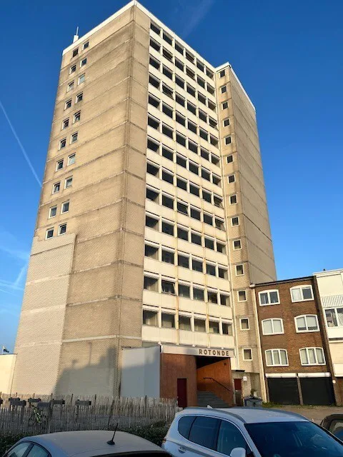
De Rotonde Flat in Zandvoort: a complete building mapped from a representative sample Anyone who has crossed the central square by Holland Casino in Zandvoort knows De Rotonde Flat. The building is a local landmark, an old and distinctive block that divides opinion: some find it ugly, some find it beautiful, everyone knows it. Buildings…
-
Read more
Halls
Reuse of halls This client specialises in building halls, but also in dismantling and reusing existing halls. An existing hall is carefully taken apart, sold and then rebuilt at another location. An important challenge here is that original drawings are often missing, outdated or no longer match the actual situation. That’s why we fully scan…
-
 Read more
Fort Benoorden Beemster
Fort Benoorden Beemster In the middle of UNESCO World Heritage Site the Beemster lies Fort Benoorden Purmerend, part of the historical Defence Line of Amsterdam. Several forts of this former defensive line have since been given a new purpose. In this case, the fort is in use by a wine wholesaler. Commissioned by a local…
-
Read more
Municipality of Haarlem
Municipality of Haarlem Everyone from the Haarlem area knows this beautiful, stately building. Commissioned by the municipality, we 3D scanned the entire building inside and out and captured the existing situation accurately in digital form. We delivered the resulting point cloud in both E57 and RCS format, so the scan data is broadly usable for…
-
Read more
Hoge Duin en Daalseweg
Hoge Duin en Daalseweg We fully 3D scanned this beautiful villa on behalf of an architect. On the basis of the point cloud, we then worked the existing situation up accurately into a Revit model. Because a 3D scan only captures what is actually visible and measurable, we supplemented the model with information from available…
-
 Read more
Johma
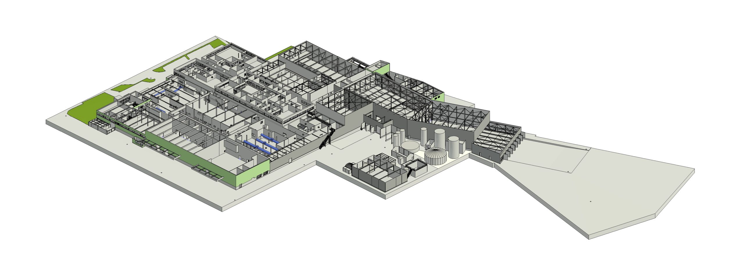
Johma: unifying a 30,000 m² factory complex in a single digital model Anyone who has walked the Johma site sees not one factory, but a chain of building sections that have grown together over the years. Every extension brought its own column structure and its own dimensions, and for many sections no accurate drawings existed…
-
 Read more
Church Hoogwoud
Church Hoogwoud No current drawings of this church, part of the municipal property, were available. To properly prepare future maintenance, management and renovation works, we were asked to map the complete existing situation accurately. With our mobile 3D scanners, we captured the church both inside and out. The resulting point cloud forms an accurate digital…
-
 Read more
Rijksmuseum
Rijksmuseum Every so often our work takes us to a very special place. This time: the Rijksmuseum in Amsterdam, after closing time! Commissioned by our client, we got to fully 3D scan all publicly accessible parts of the museum. An impressive environment where historical architecture, art and technology come together. With our mobile 3D scanners,…


