
What is 3D laser scanning? A clear explanation for clients
You’re advised to have your building scanned. But what does that actually mean? What comes out of such a scan, how long does it take and what can you then do with the data? This article gives you a clear overview, without needing technical background knowledge.
3D laser scanning is a measurement technique with which the existing situation of a building, location or installation is captured down to the millimetre. The result is a point cloud: a three-dimensional data file with millions of measurement points. That point cloud forms the digital basis for design, construction, renovation and management.

How does 3D laser scanning work?
A laser scanner emits 600,000 laser pulses per second. Every pulse hits a surface (a wall, floor, installation or frame) and bounces back. On the basis of the reflection, the scanner calculates the exact position of that point in space. By combining millions of these points, a detailed 3D image of the complete environment is created. At the same time, the scanner automatically takes 360-degree photos, so you can view the environment not only as measurement data but also visually.
Crew-B works with the NavVis VLX, a mobile scanner with which the operator walks through the building and captures the complete environment in a single pass. The big benefit of mobile scanning is that you catch every corner. There are no blind spots or missing data, something that does occur with static scanners on a fixed tripod. On top of that, it goes considerably faster: an office storey of 1,500 m² is captured within an hour. Large halls are often done in half an hour.
Important: the scanning work does not disrupt the daily use of the building. Employees, residents and visitors can just keep working. People who appear in shot during the scan are automatically removed from the data and don’t affect the quality of the end result.

What do you get after the scan?
The direct result of a 3D laser scan is a point cloud. That is a file with millions of coordinates that together form an accurate 3D representation of the scanned environment. You see walls, floors, ceilings, pipework, installations and structural elements, exactly as they are at that moment.
The cleaned-up point cloud is usually available within 24 hours of the scan. Depending on your project, you can go in different directions with that data:
Point cloud as an end product. For measurements, inspections or surface area calculations, the point cloud often suffices as a standalone product. You measure distances, check heights or record the existing situation as a reference.
Point cloud as the basis for a BIM model. If you’re going to renovate, refurbish or want to test a design against reality, the point cloud is processed into a BIM model in Revit. This process, Scan-to-BIM, is specifically aimed at existing buildings and renovation projects. The BIM model contains recognisable objects (walls, doors, pipework) to which you can add properties: material, dimensions, classification and maintenance information. Crew-B can often start modelling straight after the scan. The lead time depends on the scale and complexity of the project.
Point cloud as the basis for digital management. After scanning, Crew-B unlocks your building data via the Indoorviewer. Compare it to Google Street View, but for your own building: you walk digitally through the spaces, measure distances, mark points and share locations with colleagues or external parties. No installation needed, works in every browser. For centrally managing BIM models and documentation, Crew-B uses Autodesk Forma (formerly Autodesk Docs).
How long does a scan take?
The lead time depends on the size and complexity of the location. With the NavVis VLX, an office storey of 1,500 m² is captured within an hour. Large open halls go even faster: often half an hour. For complex locations with many installations or hard-to-reach spaces, it can take a bit longer.
The cleaned-up point cloud is usually available within 24 hours. When a BIM model is subsequently built up, the lead time depends on the scale and complexity of the project. We can often start modelling straight after the scan and always discuss the planning up front. You know what to expect before the start.

Who is 3D laser scanning relevant for?
Clients use laser scanning for a wide range of projects and situations:
Renovation and refurbishment. Existing drawings are outdated or missing. A scan delivers the current situation as a reliable basis for design and calculation.
New build and extension. When connecting to existing buildings, the exact existing situation is crucial to prevent design errors.
Property management. Property owners and managers digitally record their portfolio for maintenance, long-term maintenance planning and space management.
Monuments and heritage. With protected buildings, archive drawings are often missing or hopelessly outdated. Scanning maps the complex geometry without damaging the building.
Industry and installations. Factories and production locations scan installations for retrofit, maintenance or safety planning. Without production downtime.
Retail. Retail chains use scan data for the rollout of stores. Scan once, use repeatedly with every following refurbishment.
Government. Municipalities digitise their property portfolio for management, sustainability, tenders and permits.
Crew-B carries out the complete journey, from the first 3D laser scan to modelling, coordination and digital management. Want to know what that means for your project? Get in touch for a no-obligation conversation.


Projects we have delivered
56+ clients in 7 countries. More than 2,000 scans completed in 5 years.
-
 Read more: Boerenbond Petsplace or Odido
Boerenbond Petsplace or Odido
Boerenbond Petsplace or Odido When a retailer switches to a new store concept or interior, it often isn’t about one location, but about dozens of stores that need to be renewed in a short time. We’ve been involved in the renewal of Boerenbond/Pets Place stores and the transition from T-Mobile to Odido, among others. For…
-
 Read more: Basic-Fit
Basic-Fit
BASIC FIT For Basic-Fit we’ve scanned more than 1,300 existing and newly built locations over the past 5 years. The Digital Twin was set up on the basis of the scan. Basic-Fit uses this data for the delivery of the locations, facility management, all smart systems in the club and much more. Ask about the…
-
 Read more: CS Arnhem
CS Arnhem
CS ARNHEM Bartiméus is an organisation for the care of people with a visual impairment or blindness, and Atsence offers a solution for indoor navigation, so visually impaired and blind people can orient themselves in public spaces. A wonderful solution! Atsence uses our scan data for their software and asked us to scan Arnhem Station.…
-
 Read more: Elysee Pavilion Paris
Elysee Pavilion Paris
THE ELYSEE PAVILION In collaboration with Hypsos, we scanned and modelled this beautiful pavilion on the Champs-Élysées. To temporarily change the layout of this pavilion in preparation for the Olympic Games in Paris, we had to model all elements such as ornaments and ceiling mouldings accurately.
-
 Read more: Kenaupark Haarlem
Kenaupark Haarlem
KENAUPARK HAARLEM We fully 3D scanned this beautiful monumental building in Haarlem for a local architect and worked it up accurately in Revit. With monumental buildings, no situation is the same and existing drawings are far from always complete or current. An accurate record of the existing situation therefore forms a valuable basis for further…
-
 Read more: Monkey Town
Monkey Town
MONKEY TOWN Monkey Town is expanding into Germany, and we give every project a great start! Mülheim is the first location we scanned for Monkey Town with our mobile scanner. We used the point cloud to develop the existing situation accurately into a BIM. The BIM, exported DWG and PDF are delivered to the German…
-
 Read more: Museumplein 1 Amsterdam
Museumplein 1 Amsterdam
Museumplein 1 We scanned this beautiful building with our mobile scanner and also carried out an archive study. On the basis of the scan combined with the archive documents, the architectural and structural model was set up to BIM basis ILS. With the scan as the starting point, of course, so it’s an accurate copy…
-
 Read more: NEMO
NEMO
NEMO A special application of our 3D scans! For a client that specialises in indoor navigation, we deliver point clouds and 360° images that are used as the basis for navigation in buildings. Via an app on the phone, a user can be navigated through the building with the help of the camera and augmented…
-
 Read more: PICNIC
PICNIC
PICNIC Commissioned by Picnic, we scanned a hub in Amsterdam with the VLX and set up a Digital Twin on the basis of the point cloud. Hubs are the smaller distribution centres your groceries come from. Prior to this process, we had to set up a template with elements that recur in a Picnic hub.…
-
 Read more: Stadion Galgenwaard
Stadion Galgenwaard
Stadion Galgenwaard In collaboration with MVSA, we scanned FC Utrecht’s stadium so they can make a flying start on their project.Using GPS systems in combination with the VLX, we were able to model the stadium accurately in Revit on the exact coordinates.With the help of two scanners, we scanned the stadium as efficiently as possible…
-
 Read more: Zandvoort Rotondeflat
Zandvoort Rotondeflat
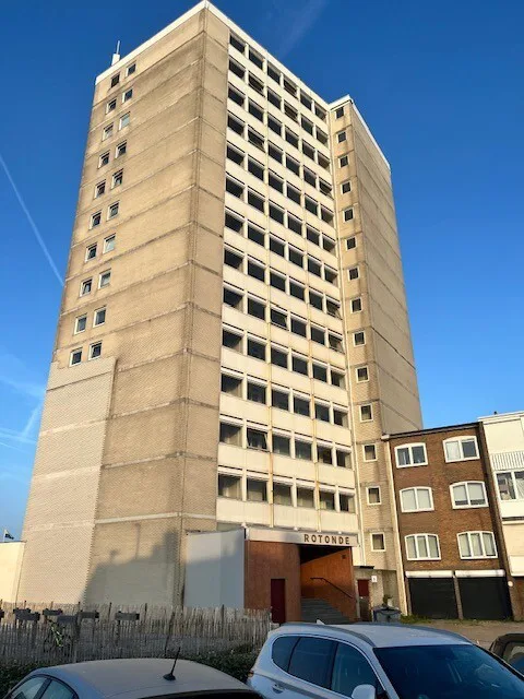
De Rotonde Flat in Zandvoort: a complete building mapped from a representative sample Anyone who has crossed the central square by Holland Casino in Zandvoort knows De Rotonde Flat. The building is a local landmark, an old and distinctive block that divides opinion: some find it ugly, some find it beautiful, everyone knows it. Buildings…
-
 Read more: Halls
Halls
Reuse of halls This client specialises in building halls, but also in dismantling and reusing existing halls. An existing hall is carefully taken apart, sold and then rebuilt at another location. An important challenge here is that original drawings are often missing, outdated or no longer match the actual situation. That’s why we fully scan…
-
 Read more: Fort Benoorden Beemster
Fort Benoorden Beemster
Fort Benoorden Beemster In the middle of UNESCO World Heritage Site the Beemster lies Fort Benoorden Purmerend, part of the historical Defence Line of Amsterdam. Several forts of this former defensive line have since been given a new purpose. In this case, the fort is in use by a wine wholesaler. Commissioned by a local…
-
 Read more: Municipality of Haarlem
Municipality of Haarlem
Municipality of Haarlem Everyone from the Haarlem area knows this beautiful, stately building. Commissioned by the municipality, we 3D scanned the entire building inside and out and captured the existing situation accurately in digital form. We delivered the resulting point cloud in both E57 and RCS format, so the scan data is broadly usable for…
-
Read more: Hoge Duin en Daalseweg
Hoge Duin en Daalseweg
Hoge Duin en Daalseweg We fully 3D scanned this beautiful villa on behalf of an architect. On the basis of the point cloud, we then worked the existing situation up accurately into a Revit model. Because a 3D scan only captures what is actually visible and measurable, we supplemented the model with information from available…
-
 Read more: Johma
Johma
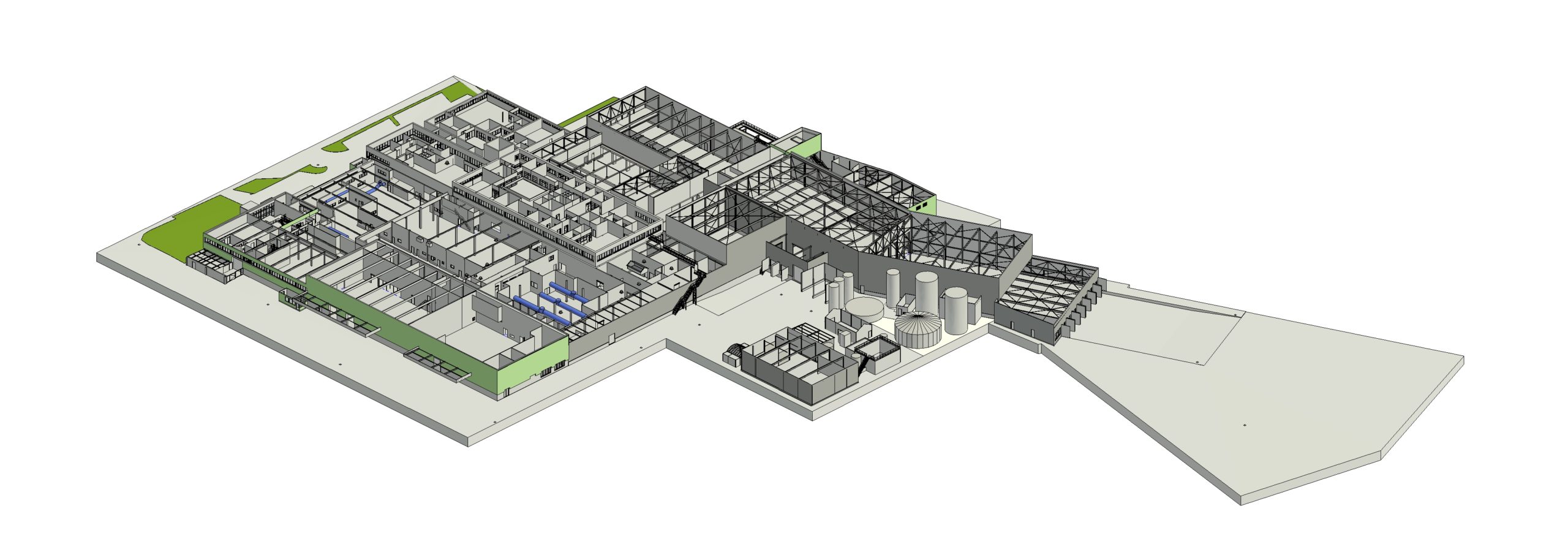
Johma: unifying a 30,000 m² factory complex in a single digital model Anyone who has walked the Johma site sees not one factory, but a chain of building sections that have grown together over the years. Every extension brought its own column structure and its own dimensions, and for many sections no accurate drawings existed…
-
 Read more: Church Hoogwoud
Church Hoogwoud
Church Hoogwoud No current drawings of this church, part of the municipal property, were available. To properly prepare future maintenance, management and renovation works, we were asked to map the complete existing situation accurately. With our mobile 3D scanners, we captured the church both inside and out. The resulting point cloud forms an accurate digital…
-
 Read more: Rijksmuseum
Rijksmuseum
Rijksmuseum Every so often our work takes us to a very special place. This time: the Rijksmuseum in Amsterdam, after closing time! Commissioned by our client, we got to fully 3D scan all publicly accessible parts of the museum. An impressive environment where historical architecture, art and technology come together. With our mobile 3D scanners,…


